 Cart(
Cart(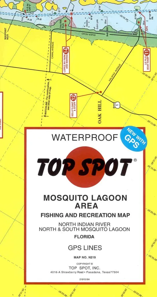
Top Spot Fishing and Recreational Map - Mosquito Lagoon Area - Map No. N219
North Indian River * North and South Mosquito Lagoon
Top Spot Fishing and Recreation Maps are waterproof maps that float! These maps have been the standard for professional and recreational anglers in our store for a decade. They are the best resource available when learning the water in a new area. Each map is packaged in a colorful cover.
The detailed information on these maps includes:
Fishing location by species and month of the year.
Diving and Wreck Location with GPS and Loran-C
Boat Ramp and Facilities
Navigation Beacons
Depth
Contact information for guides used
GPS and Loran-C Data
Diving and Wreck Location with GPS and Loran-C
Boat Ramp and Facilities
Navigation Beacons
Depth
Contact information for guides used
GPS and Loran-C Data


")


![Thermos Stainless King Vacuum Insulated Food Jar w/Folding Spoon - 16 oz. - Stainless Steel/Matte Black [SK3000BKTRI4]](https://www.climbinggeara.com/image/thermos-stainless-king-vacuum-insulated-food-jar-wfolding-spoon-16-oz-stainless-steelmatte-black-sk3000bktri4_y5vqyo_300x.webp "Thermos Stainless King Vacuum Insulated Food Jar w/Folding Spoon - 16 oz. - Stainless Steel/Matte Black [SK3000BKTRI4]")

